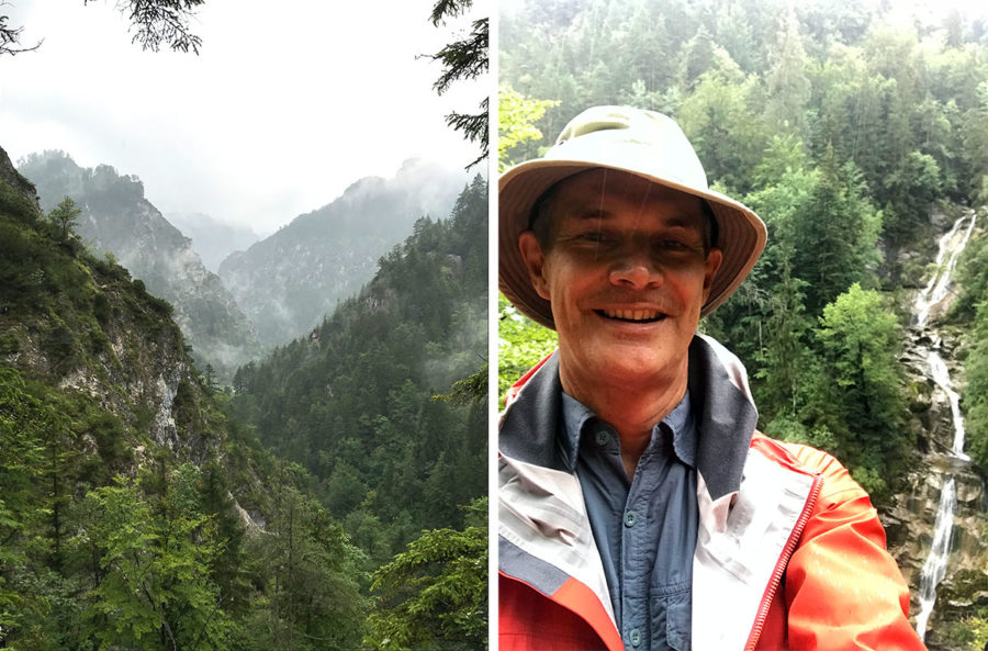
“So,” said my senior visitor. “You are going walking in Lower Austria. I guess that must be pretty flat?”
“Er, no,” I said. “Bits of Lower Austria are flatter than bits of some other Austria provinces; but Lower Austria has plenty of mountains.”
My visitor looked at me sceptically.
Lower Austria is the largest of the nine Austrian federal provinces. It encircles Vienna, borders Czechia and Slovakia, and covers 19,000 square kilometers – similar to Wales – with a great range of terrain. Yet the idea that Lower Austria is a rather flat place is surprisingly well entrenched amongst visitors to Austria.
To give an idea of how misleading this is, check out these pictures I recently took in the Ötschergräben – a wild landscape of cliffs, peaks and swirling mists as dramatic as one could wish for. The drama of the pictures was enhanced by the fact that, on a walk of five and a half hours, it rained for five and a half hours.
The moral of the story: a) Lower Austria is a fantastically beautiful province full of dramatic scenery and worth a visit; and b) Lower Austria is not “low”. In fact, it’s a great place for a hike.
Footnote: “Lower Austria” (Niederösterreich) and “Upper Austria” (Oberösterreich) actually derive their names from the mid-13th century, when “Upper Austria” – then including various other geographical areas no longer in today’s province – was the area “above” the Enns river; and “Lower Austria” was the area below the Enns. So now you know.

